We design and build.
Our architects and builders work on your home in one studio, so cost and buildability are tested while plans can still change.

Council guide / Ryde
Ryde mixes quiet house streets with some of Sydney's busiest apartment centres. We help owners work out what their own lot allows, then design and build to suit it.
ASH / Eastwood / Completed 2022
01 / The proposition
As builders across the Ryde Council area, we keep meeting the same pattern. Most low density streets share one set of mapped numbers, yet nearby station and town centre catchments can bring State housing rules into play. Knowing which applies to your block is the first job.
The council is also more apartment based than many owners expect. The 2021 Census puts apartments and flats at 44.6 per cent of the City of Ryde's occupied homes, while separate houses sat at 40.8 per cent.
This guide explains the council wide rules that shape a house, duplex or major renovation here. It also shows how we investigate a particular property before design begins.
Extend, replace or build two
The housing mix changes sharply from suburb to suburb. Census figures show no separate houses at all in Macquarie Park and 96.8 per cent apartments in Meadowbank. East Ryde sits at the other end, with separate houses making up 92.8 per cent of dwellings.
In the house streets, the choice is usually between extending a sound home, replacing a tired one or building two dwellings on the lot. A lot's size, frontage and distance from listed stations or town centres decide whether a dual occupancy is even on the table.
Our nearest completed work shows each path. ELIPSE in East Ryde and LIME in North Ryde credit SHORE for architecture, interiors and facade. ASH in Eastwood is a duplex; its interiors and facade are SHORE's work.
Select a pin or drag to explore
Map data: Esri, HERE, Garmin · © OpenStreetMap contributors
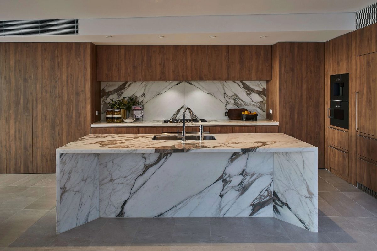
Darling Point · residential
Five apartments arranged around Sydney Harbour views, with two basement levels. Completed in 2021, with architecture and interiors by Xpace.
Council and State rules
In fourteen of the fifteen suburbs, the low density streets we sampled carried a height limit of 9.5 metres, a 0.5:1 floor space ratio and a 580 square metre minimum lot. Each street can differ and a sample is not an entitlement for any lot. A planning certificate plus a site survey confirm your position.
Before council can approve two dwellings in the R2 zone, Ryde's plan sets a 580 square metre minimum lot plus at least 15 metres of road frontage. Inside the 800 metre walking catchment of Macquarie Park, North Ryde or Meadowbank stations or of mapped centres such as Eastwood, West Ryde and Top Ryde, State standards can permit a 450 square metre site, 12 metres wide, with 0.65:1 floor space. Heritage items and bushfire prone land are excluded from those State rules.
The plan lists conservation areas in Eastwood, Denistone, West Ryde and Gladesville, including Brush Farm Park, Chatham Road and Tyrell Street. Inside them, demolition and changes to a facade need consent and heritage assessment. Council's design guidance adds character controls for the Federation era houses around Coronation Avenue and Trelawney Street in Eastwood.
A complying development certificate can be possible for a new dwelling house or a dual occupancy. It is ruled out on heritage items, in conservation areas, in mapped foreshore areas, where acid sulfate mapping shows Class 1 and Class 2 and at the highest bushfire attack levels. A certified dual occupancy still needs the council's 580 square metre minimum. Everything else needs a development application lodged with council.
Bushfire prone mapping is concentrated along the Lane Cove River corridor and Macquarie Park. Coastal and foreshore mapping follows the Parramatta and Lane Cove rivers. The State flood map shows no Ryde land, yet council holds its own flood and overland flow information, so we ask for it.
First checks
Ryde's controls are fairly consistent across house streets, so the detail of your own lot matters more than the suburb name. These four checks come first.
Eastwood, Gladesville and Melrose Park each cross a council boundary. Your planning certificate identifies the council, the zone and whether the lot carries a heritage listing.
We measure the walking distance from the lot to any listed station or mapped town centre. That decides which dual occupancy standards we design to.
Levels, trees and drainage show how the house can sit on the slope. We also check bushfire, acid sulfate, coastal and foreshore mapping for the lot.
With the limits known, our design and build teams shape the plans and price the build together.
Working with SHORE
Some owners start with an idea and a block. Others already hold drawings or an approval.
Our architects and builders work on your home in one studio, so cost and buildability are tested while plans can still change.
We review the plans and consent conditions first. Anything that could add cost or delay on site is raised before a contract is signed.
Explore our work
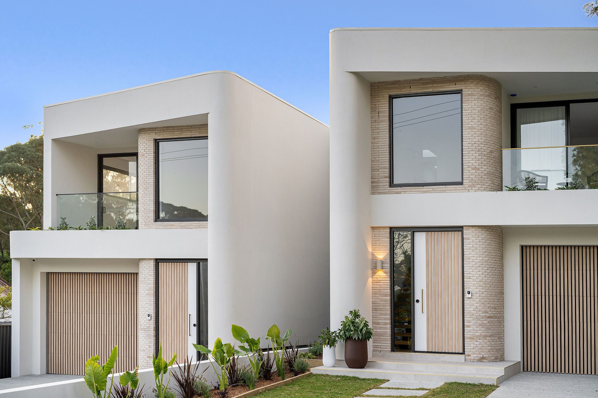
East Ryde, NSW
Completed 2024
Completed 2024. Architecture, interiors and facade by SHORE, wrapped in curved sandstone toned brick. Ryde's suburb centre is about 2.3 kilometres from East Ryde's in a straight line.
North Ryde, NSW
Completed 2023
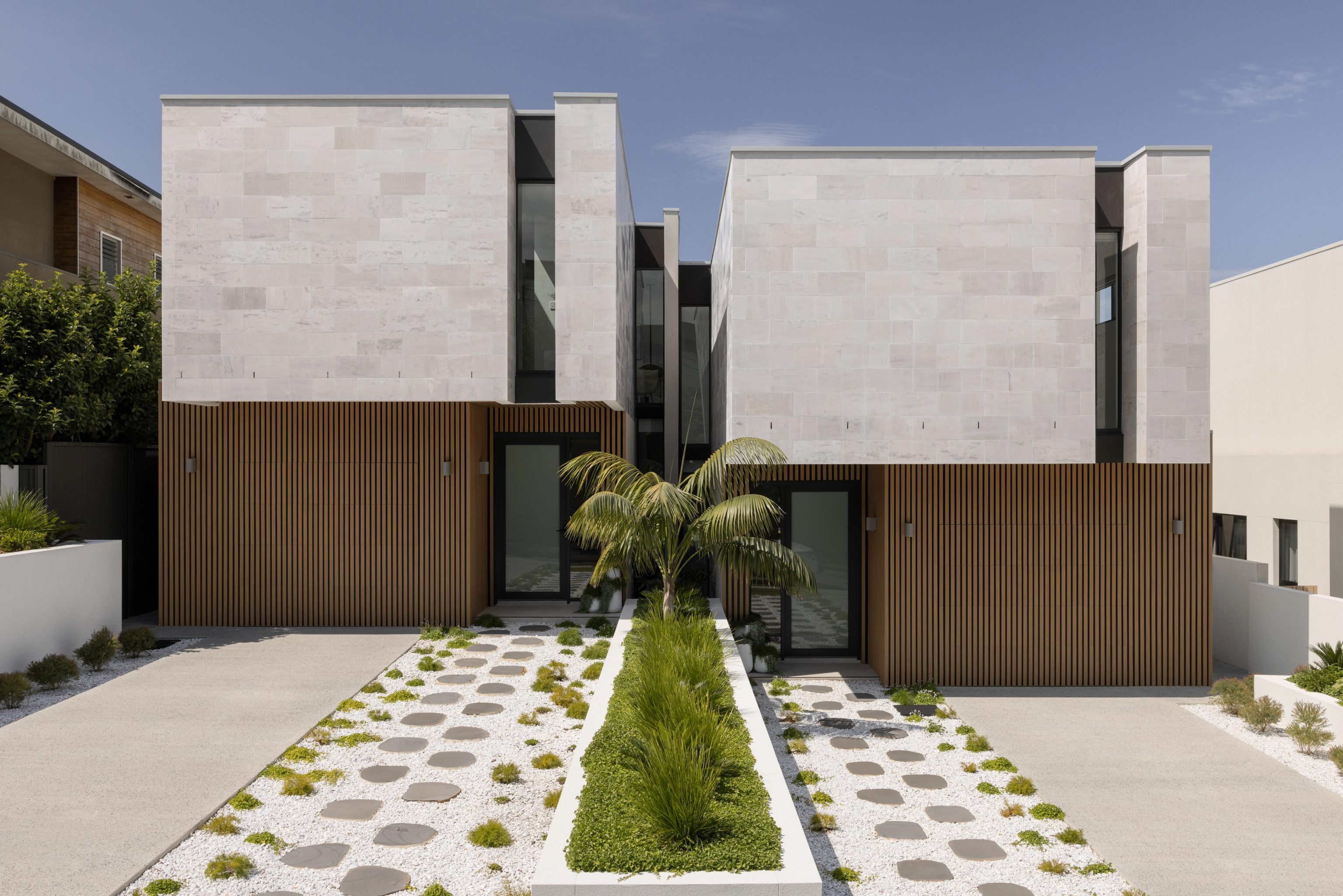
Completed 2023. Architecture, interiors and facade by SHORE, a double brick home behind a limestone facade. Marsfield's centre is about 3.3 kilometres from North Ryde's in a straight line.
Eastwood, NSW
Completed 2022
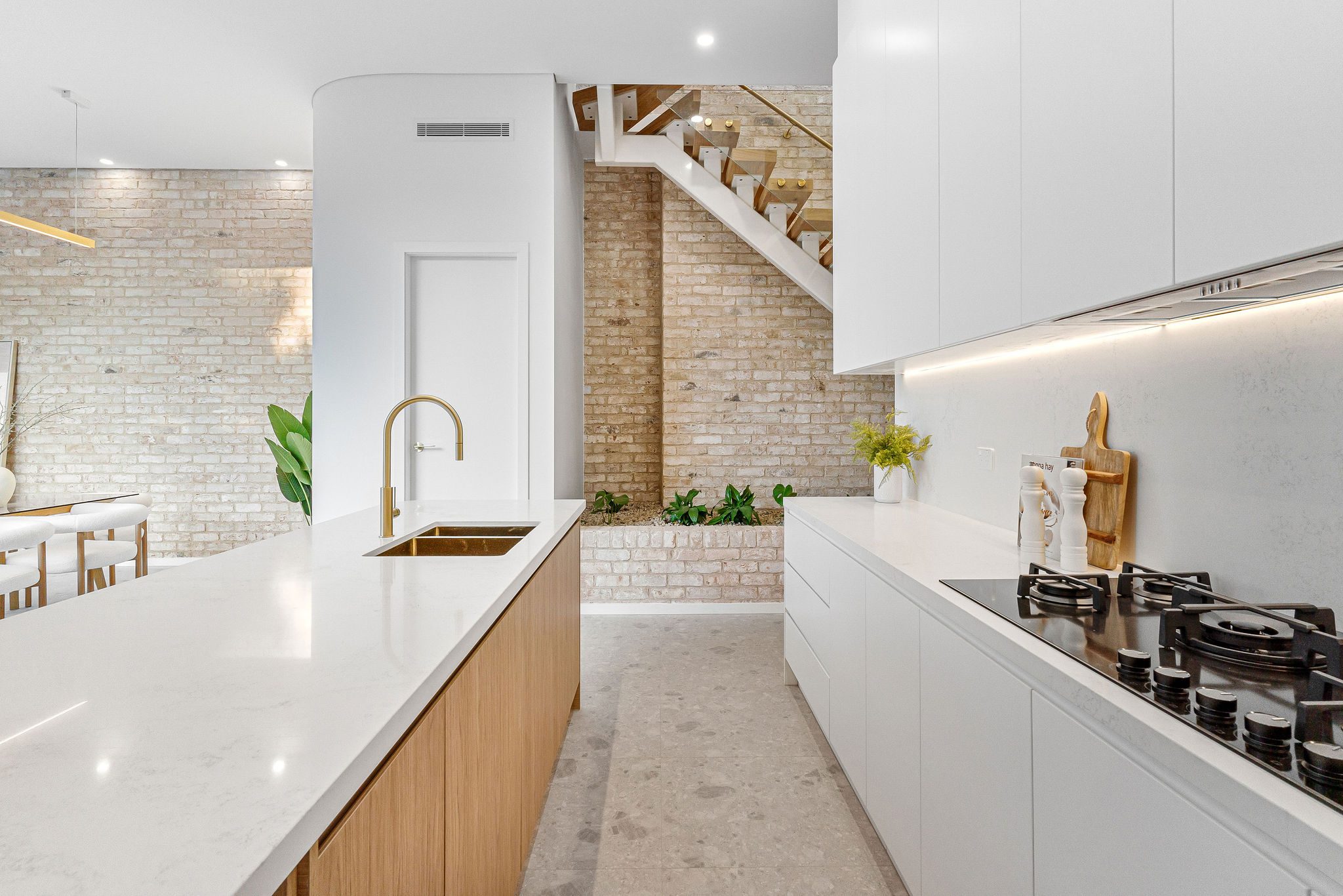
Completed 2022. A duplex with curved brick forms. Interiors and facade are by SHORE. West Ryde's centre is about 2.1 kilometres from Eastwood's in a straight line.
Suburbs in this guide
Along the Parramatta River: Putney, Tennyson Point, Gladesville, Meadowbank and Melrose Park.
Through the middle and north of the council: Ryde, West Ryde, North Ryde, East Ryde, Eastwood, Marsfield and Macquarie Park.
The Denistone group: Denistone, Denistone East and Denistone West.
Let us know your location and plans. We will look up its controls before suggesting a direction.
Questions to bring early
That depends on where the lot sits. Near the stations and town centres listed in the State policy, State standards can apply, including 450 square metre lots and 0.65:1 floor space. Elsewhere the council minimums are a 580 square metre lot and a road frontage of 15 metres. We measure the walking distance and read the planning certificate before comparing two dwellings with a single house.
Not always. For an attached dual occupancy on R2 land, Ryde's plan limits any dwelling without a road frontage to 5 metres in height. In practice that points to a single storey rear home. Where State standards apply, we check how they interact before the first sketch.
Under the house footprint, council's design rules generally cap excavation at 1.2 metres, with fill held to 900 millimetres. Beyond the footprint the caps drop to 900 millimetres of cut and 500 of fill. A variation is assessable, though our first move is a design that follows the site's fall.
No. The State's flood planning layer has no mapped Ryde land, yet Ryde's plan still applies flood planning controls where council considers land to be within the flood planning area. Ryde's design rules also bar fill in overland flow paths. We ask council for its flood information early in the design.
Take the next step