
A design and build project.
One team manages feasibility, design, approvals and construction, so the flood, bushfire, slope and heritage checks are resolved as part of the design.

Council guide / Penrith
Detached houses dominate Penrith. A typical R2 lot has a mapped 8.5 metre height cap and a 550 square metre minimum. The rules change near the Nepean floodplain, on bushfire prone edges and in the State precincts around St Marys.
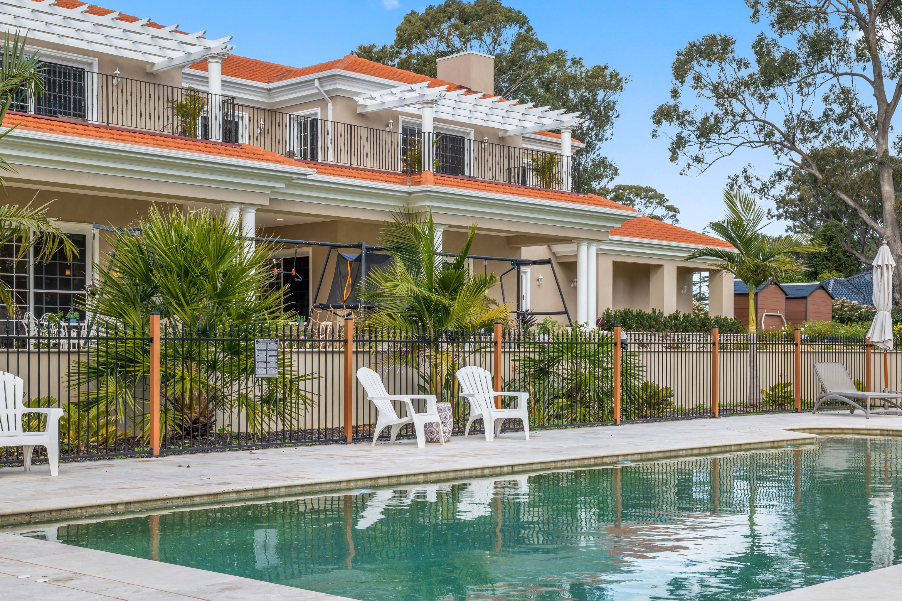
CHATEAU / Denham Court / Completed 2021
01 / The proposition
We are builders across the Penrith council area for owners planning new houses, larger additions and dual occupancies. Penrith Local Environmental Plan 2010 and Penrith Development Control Plan 2014 set the rules for most of the city. State precinct plans cover parts of the city as well, including land around St Marys and the Penrith Lakes scheme.
The housing divides sharply. Census counts from 2021 put separate houses at 78.3% of occupied homes in the council area, with 12.2% semi-detached homes and townhouses and 9.1% apartments. The older rail corridor suburbs mix housing types: Penrith suburb was 43.4% apartments, while St Marys was 51.2% separate houses and Kingswood 44.7%. The newer western estates are almost all detached homes, including St Clair at 98.4% and Mulgoa at 99.7%.
Homes from a full set of architectural drawings are also part of our work.
Screening first
We begin with the parcel record. St Marys crosses into Blacktown, while Agnes Banks reaches into Hawkesbury and Luddenham and Kemps Creek reach into Liverpool. The council also shares boundaries with Blue Mountains, Fairfield and Wollondilly. Parts of St Marys, Jordan Springs and the lakes area sit under State precinct plans instead of the local plan, so the certificate check comes before anything else.
Then we test the lot. Inside R2 low density areas, a subdivision lot needs a 15 metre width and usually a minimum of 550 square metres on the Lot Size Map. A dual occupancy needs 650 square metres if attached or 750 square metres if detached. A battle-axe lot cannot have one. Near Penrith town centre, the State's low and mid rise policy can change those numbers on eligible land.
Water and hazard come next. Flood risk follows the Nepean River, South Creek and around 40 creek systems that drain into them. Floor levels are set from the flood planning level. Parts of Glenmore Park, Emu Heights, Leonay, Mulgoa and Orchard Hills are mapped bushfire prone land. We check the planning certificate and the hazard maps before drawings are fixed.
No SHORE home is published in this council area. Three projects nearby appear lower on this page.
Select a pin or drag to explore
Map data: Esri, HERE, Garmin · © OpenStreetMap contributors
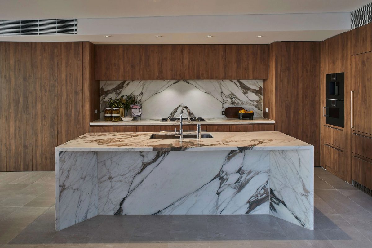
Darling Point · residential
Five apartments arranged around Sydney Harbour views, with two basement levels. Completed in 2021, with architecture and interiors by Xpace.
Statutory controls
Most houses sit in R2 low density areas, where the mapped height is 8.5 metres and the minimum lot is 550 square metres. A floor space ratio is mapped on very few residential sites, so the DCP envelope, setbacks and landscaped area carry much of the design work. Values differ between streets and precincts.
In R2, a subdivision lot needs a 15 metre width and a minimum of 550 square metres. A dual occupancy needs 650 square metres if attached or 750 square metres if detached. A battle-axe lot cannot have one. In R3, a dual occupancy needs 550 square metres attached or 650 square metres detached on a standard lot. Within 800 metres walking distance of the Penrith town centre, the State's low and mid rise policy can permit a dual occupancy where a 450 square metre site has a 12 metre frontage, a floor space ratio up to 0.65 to 1 and a height up to 9.5 metres on eligible land outside the exclusions.
The Nepean River, South Creek and about 40 creek systems shape the floodplain. Council flood studies define the flood planning area. Habitable floors generally sit at or above the council's flood planning level, which is the 1% flood level plus half a metre. Once only extensions up to 35 square metres may be treated differently. A planning certificate and a parcel check decide what applies.
Six conservation areas cover small pockets in Penrith, North St Marys and Wallacia. Schedule 5 lists more than 200 heritage items and 13 archaeological sites, most of them in Penrith, Emu Plains and St Marys. The Housing Code is not available for a new home or addition inside a conservation area, apart from a pool, a detached outbuilding and some other detached work.
Bushfire prone land covers parts of Mulgoa, Orchard Hills, Emu Heights, Glenmore Park, Leonay and Cranebrook. The DCP asks for geotechnical advice where the slope is over 15% and does not permit a building where the existing slope is over 20%. The DCP generally limits dwelling cut and fill to 600 millimetres, with ground floors no more than 800 millimetres above natural ground. In the south, the Western Sydney Airport noise contours cross parts of Kemps Creek, Luddenham and Mount Vernon, where aircraft noise rules can limit complying development and require acoustic construction.
How a Penrith project runs
Flood levels, escarpment slopes, creek corridors and the older town centres each bring their own constraints. We settle those questions before the layout is fixed.
We establish which council and instrument apply, then read the zone, the heritage status, the flood notation and the bushfire category from the certificate and maps.
We model the 8.5 metre R2 height limit, the DCP setbacks and the landscaped area requirement, then test cut and fill against the site slope and the 600 millimetre guide.
We review the flood planning level, any site flood study or hydraulic certification and what a geotechnical report or salinity analysis would change on a sloping or low lying block.
Driveway grades, tree protection, parking numbers and rural services such as water and effluent are priced in from the start instead of being sorted out on site.
How owners engage us
You can come to us with a property to rework or with drawings ready for pricing.
One team manages feasibility, design, approvals and construction, so the flood, bushfire, slope and heritage checks are resolved as part of the design.
Share the drawings and any consent conditions. Our review covers the flood and bushfire detail, the site levels and access, then we price the work with the outstanding investigations named clearly.
Explore our work
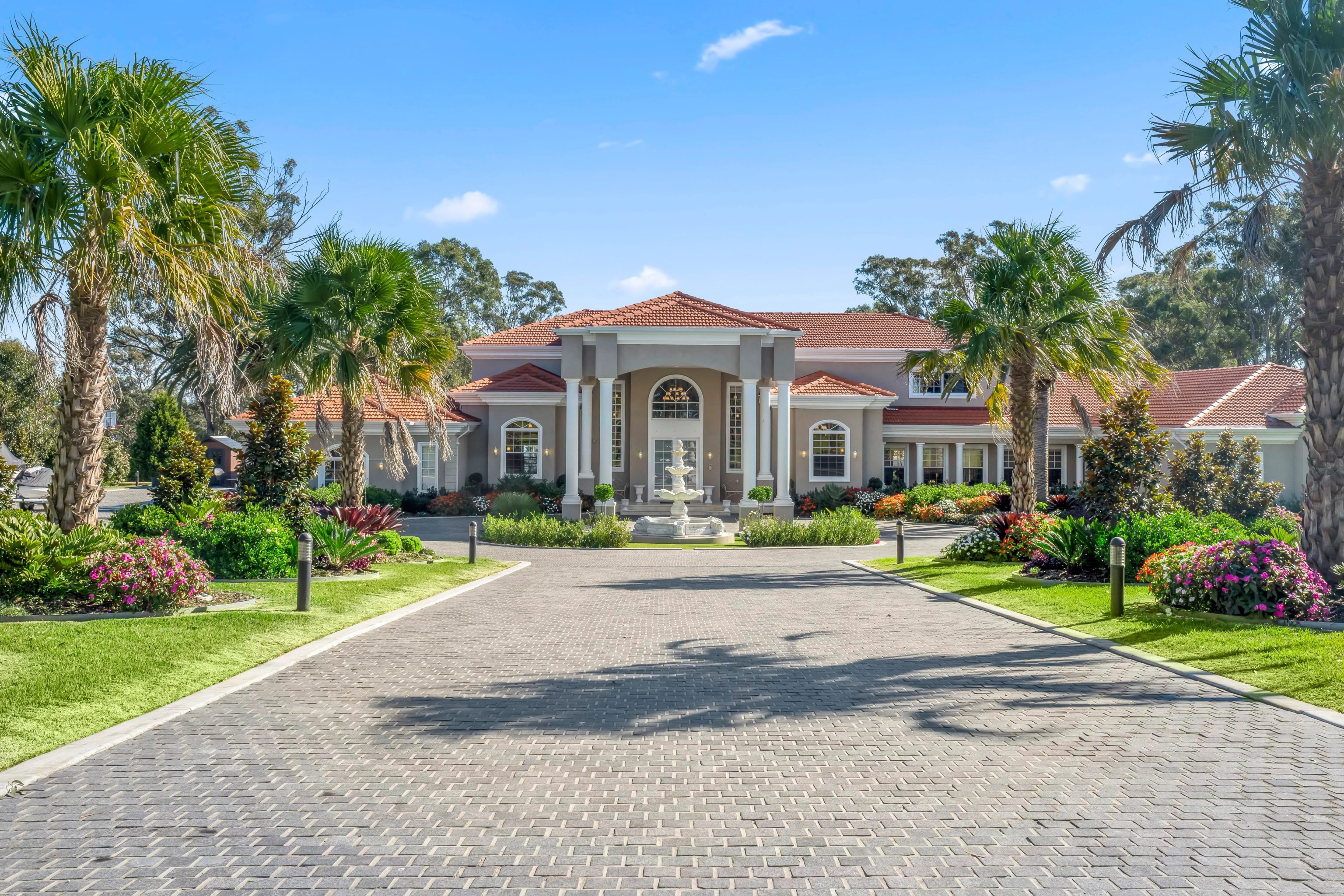
Denham Court, NSW
Completed 2021
A French Provincial estate on five acres in Denham Court, completed in 2021 with seven bedrooms and four bathrooms. SHORE designed the architecture, interiors and facade and built the residence. Denham Court is about 20.9 kilometres from St Clair in a straight line between the calculated centres of the two suburb areas.
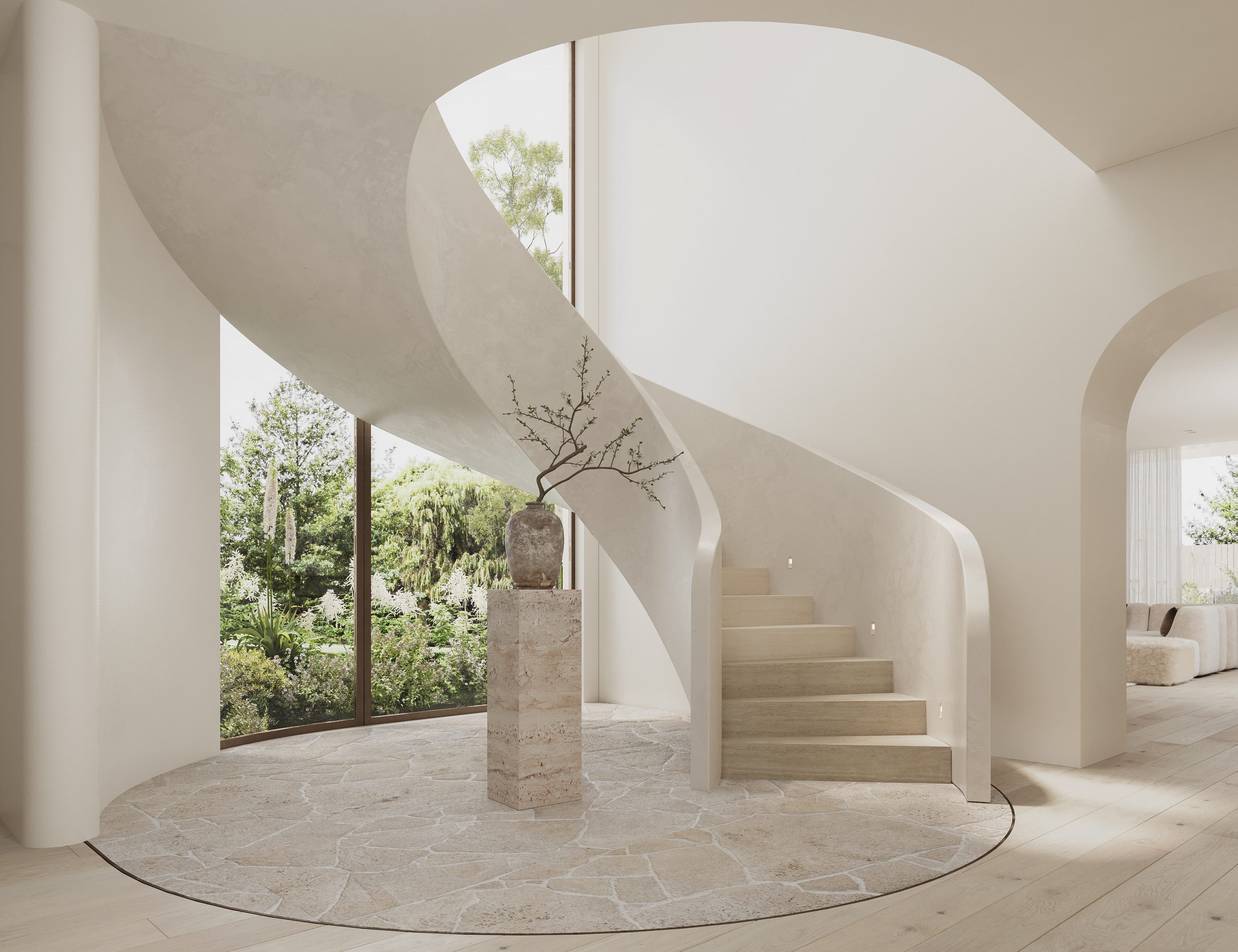
Carlingford, NSW
Under Construction
A pair of sculptural dual occupancy residences in Carlingford, under construction, with five bedrooms and four bathrooms. SHORE designed the architecture, interiors and facade and is building the pair. Carlingford is about 24.2 kilometres from St Clair in a straight line between the calculated centres of the two suburb areas.
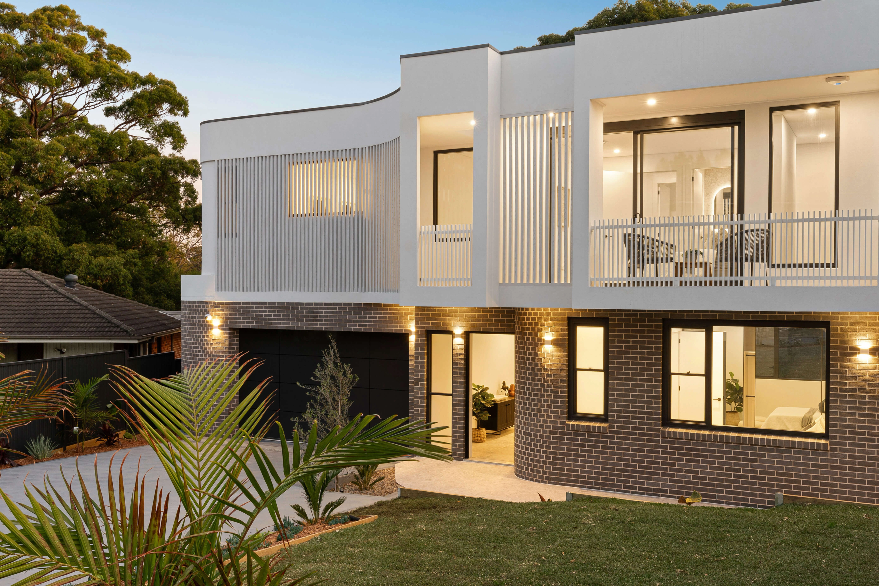
Ermington, NSW
Completed 2023
A two storey contemporary residence on an 850 square metre lot in Ermington, completed in 2023 with five bedrooms and four bathrooms. Peak Architects designed the architecture and SHORE delivered the interiors, facade and construction. Ermington is about 25.5 kilometres from St Clair in a straight line between the calculated centres of the two suburb areas.
Localities served
These 34 localities sit under this council on our service map: Agnes Banks, Berkshire Park, Caddens, Cambridge Gardens, Cambridge Park, Castlereagh, Claremont Meadows, Colyton, Cranebrook, Emu Heights, Emu Plains, Erskine Park, Glenmore Park, Jamisontown, Jordan Springs, Kemps Creek, Kingswood, Leonay, Llandilo, Londonderry, Luddenham, Mount Vernon, Mulgoa, North St Marys, Orchard Hills, Oxley Park, Penrith, Regentville, South Penrith, St Clair, St Marys, Werrington, Werrington County and Werrington Downs.
This is the service map's directory, not a claim that every cross boundary suburb lies wholly in the city. St Marys sits mostly here with an edge in Blacktown. Agnes Banks crosses into Hawkesbury. Luddenham and Kemps Creek cross into Liverpool. Much of Castlereagh, Berkshire Park, Kemps Creek, Luddenham and Orchard Hills is rural, employment or environmental land where house work is uncommon. Every parcel gets checked against its own maps before we draw.
Questions to bring early
The answer starts with the zone and the lot size. In R2, a dual occupancy needs 650 square metres if attached or 750 square metres if detached. A battle-axe lot cannot have one. In R3 the minimums are 550 square metres attached or 650 square metres detached on a standard lot. Within 800 metres walking distance of the Penrith town centre, the State's low and mid rise policy can permit a dual occupancy where a 450 square metre site has a 12 metre frontage on eligible land. Bushfire prone land, heritage items, land in the Hawkesbury Nepean probable maximum flood extent and other listed exclusions do not qualify.
About 40 creek systems drain to the Nepean River or South Creek. Council has flood studies for many of these catchments and more are under way. A flood notation can appear on the planning certificate. Habitable floors generally sit at or above the council's flood planning level, which is the 1% flood level plus half a metre. Use flood compatible materials below that line and provide a surveyor's floor level certificate at completion. Once only extensions up to 35 square metres may be considered differently. A larger addition is treated as new work.
That route can work when the lot and the design meet the Housing Code. The lot needs to be at least 200 square metres and 6 metres wide at the building line in a residential zone. The new house height limit is 8.5 metres. The route is closed inside a conservation area for new houses and additions. The same applies on listed heritage items, land in the flame zone or at bushfire attack level 40 and any part of a flood control lot without certification that it is clear of flood storage, floodway, flow path, high hazard or high risk areas. A parcel check decides.
The DCP expects the design to follow the slope rather than flatten it. A geotechnical report may be required where the slope is over 15%. A building is not permitted where the existing slope is over 20%. Cut and fill for a dwelling is generally limited to about 600 millimetres, with ground floors no more than 800 millimetres above natural ground. Driveway grades are limited to 20%. Split level or pier designs are common answers on the western escarpment.
Ready when you are