Skip to page content
SHORE

Council guide / Parramatta

Architectural builders across the Parramatta council area

From the Epping ridge to the river flats of Ermington, the same council plan reads very differently from one street to the next. We design and build houses with those differences worked out before the drawings are fixed.

ULM / Ermington / Completed 2023

01 / The proposition

One council, several planning landscapes

Every residential project begins with the specific planning controls governing your block. Across the Parramatta council area, local builders navigate one consolidated instrument introduced in March 2023 that unified the former Parramatta, Auburn, Holroyd and Hills planning schemes. Even within that single framework, site rules change sharply between heritage streets, riverbank settings and leafy bushland perimeters.

Dwelling patterns vary just as dramatically. In 2021 Census counts, approximately 47% of local residences were apartments, yet free standing homes made up roughly 88% of dwellings in Winston Hills. Designing a new residence in North Rocks involves completely different site priorities than building near the urban core.

We provide an integrated design and construction pathway that guides your project from early architectural concepts through completion. When you already have documentation from an independent architect, we step in purely as head contractor to deliver the build.

What to settle first

Three questions that shape a Parramatta house brief

First, confirm which plan applies. Most streets follow the council's 2023 plan. Sydney Olympic Park, however, sits under a State precinct policy and some precincts carry their own chapters, so a control quoted for one area may not carry over.

Next, check whether your block can hold what you want. A second dwelling, a larger footprint or a deeper excavation each depends on lot size, frontage and the overlays recorded for that land.

Finally, decide whether the existing house has a future. Inside a conservation area that decision involves heritage assessment from the outset. Elsewhere it usually comes down to condition, layout and the budget for keeping or replacing the structure.

SHORE Design + Build Architectural Cartography

Loading Architectural Map...
SHORE DESIGN + BUILD · LOCATIONS ARE APPROXIMATE

Select a pin or drag to explore

Map data: Esri, HERE, Garmin · © OpenStreetMap contributors

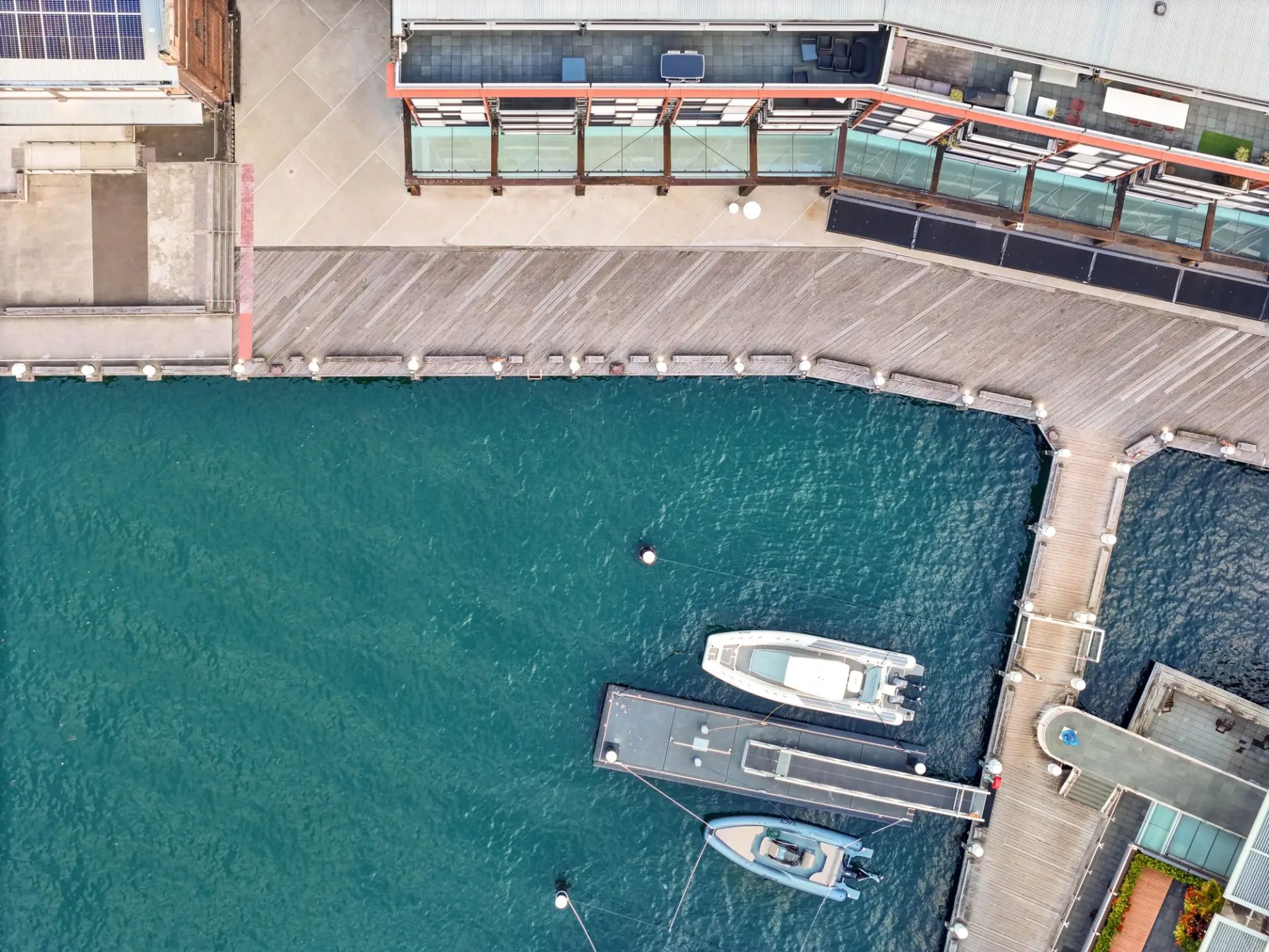
ALOFT project in Darling Point
Loading photo…
Completed 2021

Darling Point · residential

[ ALOFT ]

Five apartments arranged around Sydney Harbour views, with two basement levels. Completed in 2021, with architecture and interiors by Xpace.

Map locationDarling Point · Indicative location
Xpace (Architecture & Interiors) · SHORE (Construction Delivery)
Explore project details

Planning controls

Lot rules, heritage, river land and bushland

Across surveyed residential streets, building heights commonly sit at 9 metres with a 0.5:1 floor space coefficient. Certain pockets in Harris Park limit height to 6 metres with no prescribed density ratio, illustrating why controls must be verified lot by lot.

  1. 01

    Dual occupancy prerequisites.

    Parramatta LEP 2023 mandates a parcel threshold of 600 square metres alongside street frontage spanning 15 metres minimum. Crucially, clause 6.11 prevents dual residences on land designated on council dual occupancy prohibition overlays, which affect sampled addresses in Epping and Harris Park. State low rise provisions near transport nodes may alter these baselines, requiring parcel verification with planning authorities.

  2. 02

    Fifteen heritage conservation precincts.

    Council schedules identify 15 conservation areas across the municipality, encompassing Experiment Farm, Harris Park West, South Parramatta, Essex Street and East Epping. Erecting a new home or undertaking demolition inside these zones mandates formal development consent. Under the Housing Code, complying development is closed there for new homes and additions, apart from detached outbuildings, some other detached structures and swimming pools.

  3. 03

    Catchment and overland flow factors.

    Because spatial portal layers omit a consolidated flood layer for this instrument, official planning certificates provide the conclusive record of flood control classification. Council's 2024 Parramatta River study highlights that stormwater runoff and overland paths cause substantial local inundation. Properties bordering the watercourse may also contend with statutory foreshore building lines.

  4. 04

    Bushfire buffers and topography.

    Vegetated buffer corridors intersect residential parcels across North Rocks, Northmead, Oatlands and North Parramatta. Complying development is excluded in BAL 40 and the flame zone. Below that it is possible only when road access, power, water supply and hydrant conditions are met and no other exclusion applies. Where land gradients exceed 20%, development controls trigger compulsory geotechnical engineering signoff.

Project progression

Establishing site certainty before construction

Crucial property constraints across Parramatta are documented in statutory records before site work starts. We uncover these parameters during early project planning so architectural concepts reflect real boundary conditions.

  1. Examine the planning certificate.

    We obtain the section 10.7 certificate to confirm zoning restrictions, heritage conservation overlays and flood designations. These notes show whether complying development exclusions apply to the land, which tells us early whether a private certifier route is worth testing.

  2. Evaluate property dimensions.

    Site area, boundary width, permissible wall heights and floor space ratios are measured directly against client aspirations. If you are proposing dual dwellings, we consult the local prohibition mapping alongside relevant State housing provisions.

  3. Commission targeted engineering investigations.

    Depending on site geography, we coordinate geotechnical slope stability reports, overland flow studies, bushfire attack levels or acid sulfate soil testing. Only technical studies essential to your parcel are commissioned.

  4. Establish firm construction costings.

    Detailed building figures reflect finished architectural drawings, specialist consultant findings and defined interior finishes. Provisional sums are avoided by clarifying structural requirements early.

Engagement models

Tailored delivery for your property

Clients engage us at distinct stages of the residential journey. Whether you hold a bare block or ready to build documentation, our team structures the project accordingly.

Turnkey architectural creation.

We handle architectural documentation, interior joinery, council approvals and physical construction under a single unified contract. This model delivers seamless coordination from preliminary sketches to final occupation.

Constructing independent architectural plans.

If you already retain an external architect, we collaborate closely during preconstruction. We examine construction sequencing, buildability and material selections before tender. At ULM in Ermington we worked with Peak Architects on the interiors and facade.

Substantial redevelopment and replacement homes.

Replacing an existing dwelling requires verifying demolition rights and establishing whether heritage conservation, overland flow or bushfire buffers restrict site layout. We assess redevelopment feasibility before initiating structural design.

Duplex and dual occupancy developments.

Unlocking multiple residences on a single parcel demands compliance with 600 square metre minimums, 15 metre frontages and exclusion zone maps. Our Carlingford project SOLICE, a pair of residences designed by SHORE, is under construction.

Explore our work

Our work in Ermington and Carlingford

[ ULM ]

[ ULM ]

Ermington, NSW

Completed 2023

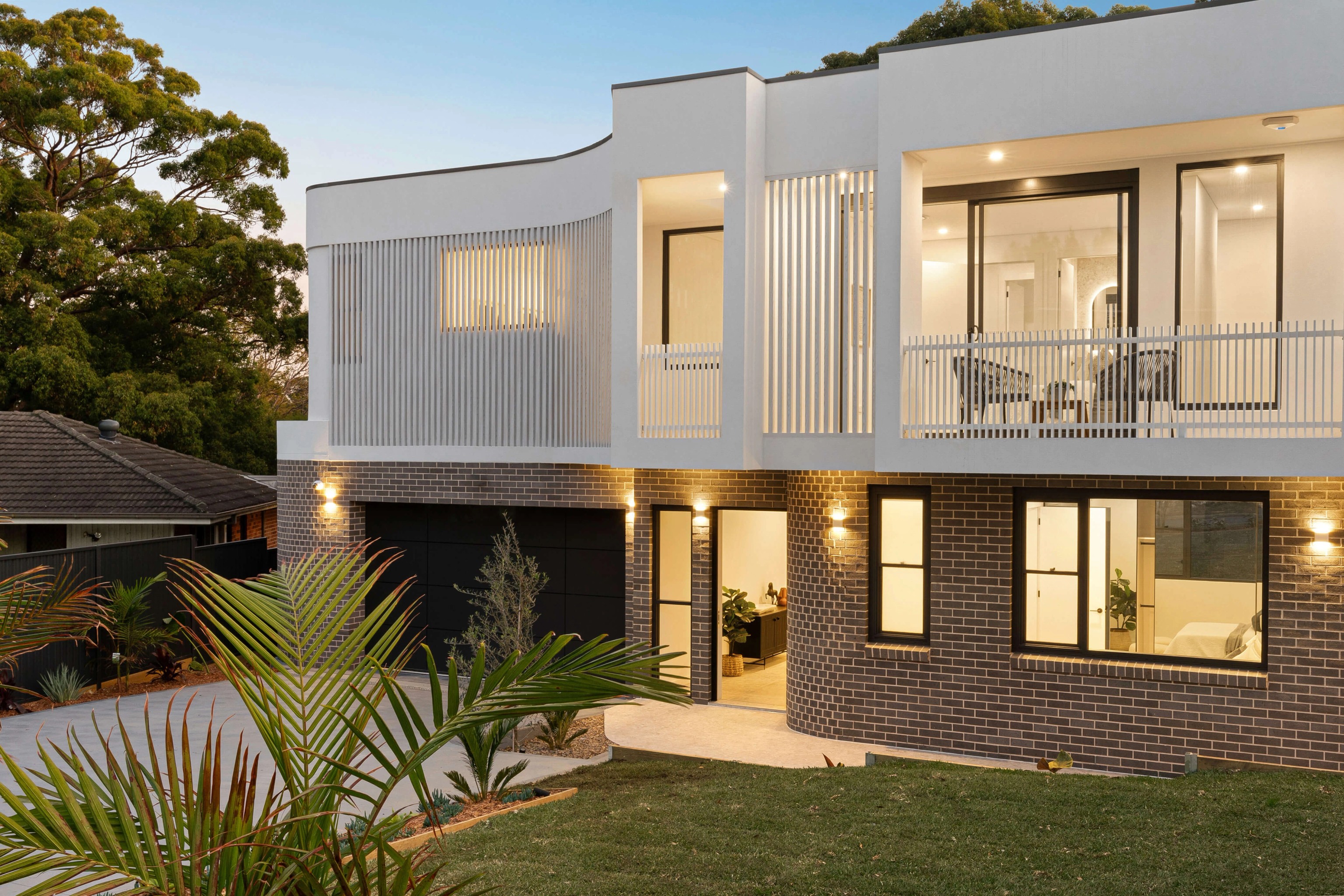
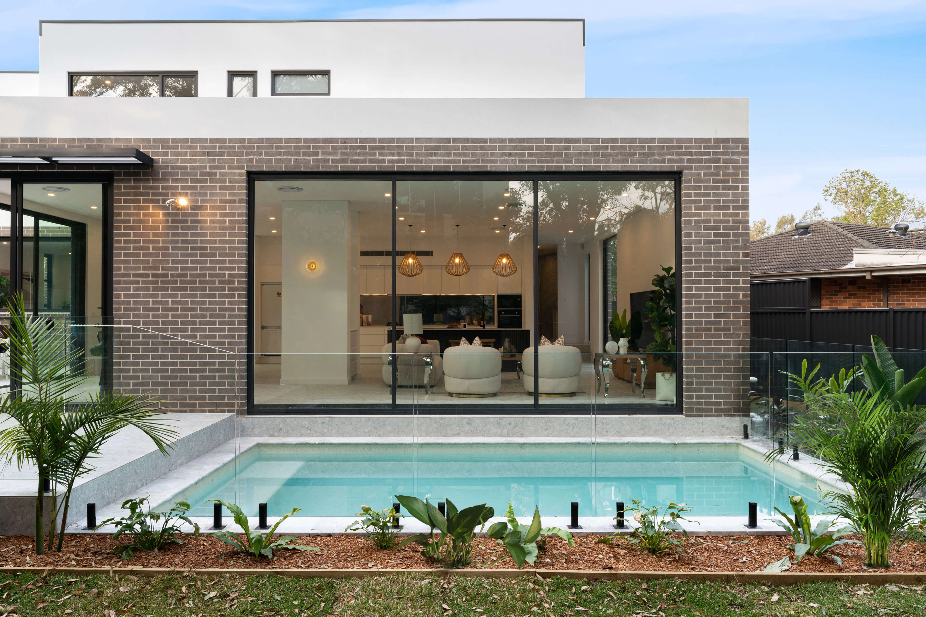
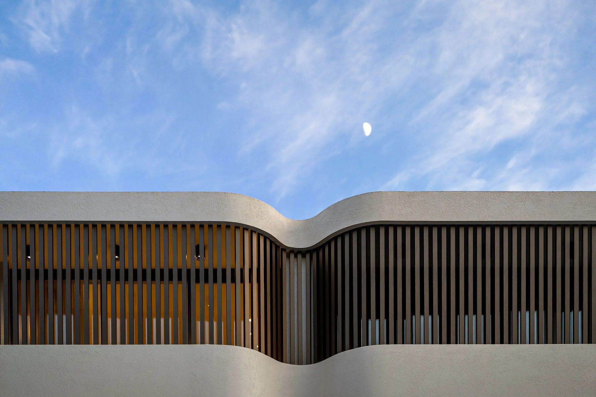
Completed 2023. A two storey Ermington home with a curved, battened upper level over dark brick, opening to a rear pool terrace. Architecture by Peak Architects, with SHORE responsible for interiors and facade.

Architecture
Peak Architects
Interiors & facade
SHORE
[ SOLICE ]

[ SOLICE ]

Carlingford, NSW

Under Construction

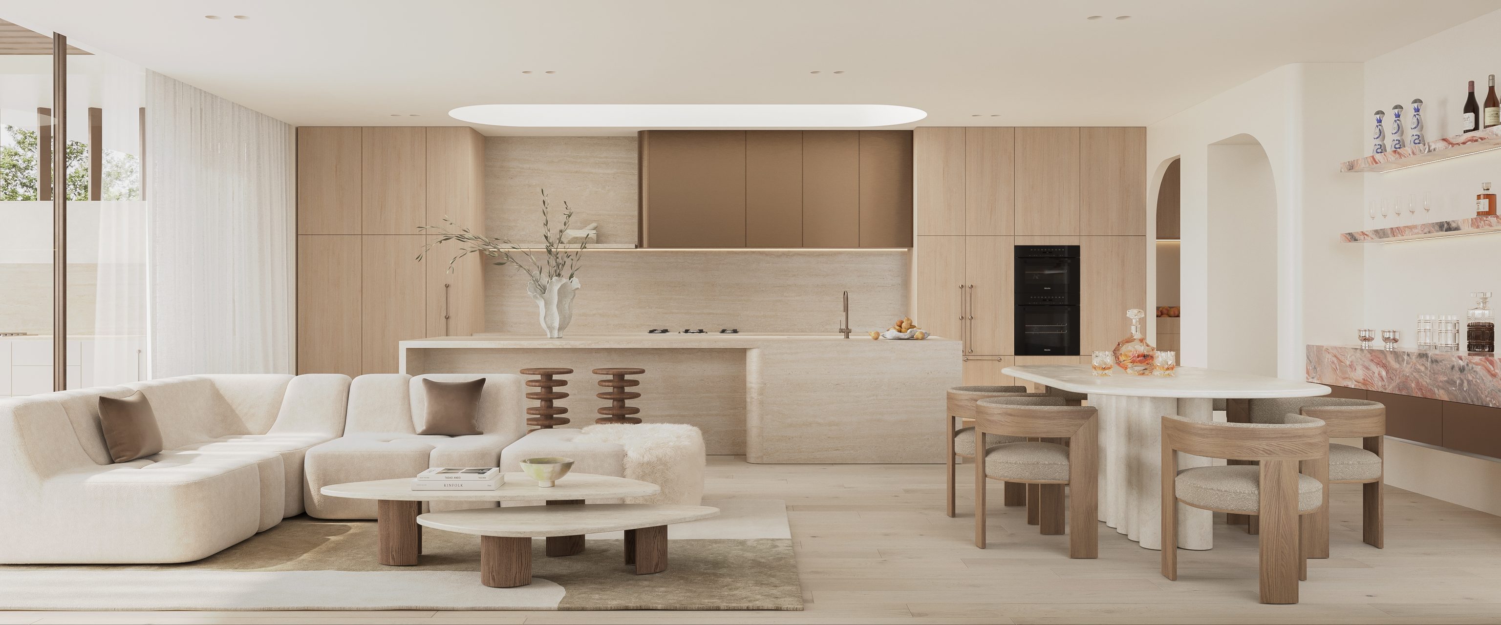
Under Construction. A pair of residences in Carlingford, designed by SHORE for architecture, interiors and facade. The image is a design rendering of the interior.

Architecture
SHORE
Interiors & facade
SHORE

Twenty five localities

Suburbs within the Parramatta council area

Northern and western house suburbs: Epping, Carlingford, North Rocks, Winston Hills, Northmead, Oatlands, Telopea, Dundas, Dundas Valley, Constitution Hill, Old Toongabbie and Toongabbie.

Around the city centre and the river: Parramatta, North Parramatta, Harris Park, Westmead, Rosehill, Rydalmere and Ermington.

Eastern waterfront and Olympic precincts: Wentworth Point, Newington, Sydney Olympic Park and Silverwater.

Largely industrial and employment land: Camellia and Clyde.

Toongabbie and Westmead are shared almost evenly with neighbouring councils. Small parts of North Rocks and Winston Hills fall outside the City of Parramatta. Forward property specifics during your initial enquiry and our team will verify municipal boundaries before reviewing statutory provisions.


Questions to bring early

Questions about building in the Parramatta council area

Is my Epping or Carlingford home under Parramatta council?

Almost certainly, though boundary edges warrant attention. NSW boundary data places about 99% of each suburb in the City of Parramatta. Under the 2023 local plan, Hornsby's planning controls no longer apply to that land. Parcels directly along Hornsby or The Hills borders can fall into neighbouring council territory, which we verify prior to site investigations.

Can I build a dual occupancy on my block?

Begin by checking whether your parcel satisfies the 600 square metre threshold and 15 metre boundary breadth stipulated in Parramatta LEP 2023. Next, confirm that the property escapes exclusion on council dual occupancy restriction maps. Near key transit hubs, overarching State housing policies may introduce alternative density criteria, which we clarify prior to preliminary drafting.

How do we determine if a property is flood affected?

We review the section 10.7 certificate to see whether council designates the parcel as a flood control lot. Council's development control plan sets the flood planning level at the higher of the 1% AEP river or overland flow flood level plus at least 500 millimetres of freeboard. When a site carries flood notation, both structural footing elevations and consent pathways align to those benchmarks.

Does a conservation precinct prevent complying development?

For complete residential builds, yes. In a heritage conservation area, the Codes SEPP closes the Housing Code route for new homes and additions, apart from detached outbuildings, some other detached structures and swimming pools. Constructing a bespoke dwelling or executing major structural extensions in these streets necessitates lodging a standard development application with council.

Property evaluation

Consult our team regarding your Parramatta residence

Provide your street address and project aspirations. If you have obtained a recent planning certificate, pass it through so our architectural team can identify primary development opportunities and reporting requirements.

Discuss my project
AboutProjects