
Architectural design and construction.
Our architects, interior designers and builders take your home from feasibility and concept sketches through council or certifier approvals, engineering coordination and full construction under one agreement.

Council guide / Campbelltown
Campbelltown spans railway suburbs around Ingleburn and Minto, release estates in Bardia and Menangle Park and acreage around Wedderburn. Its local plan pairs a two storey height cap with bushfire, slope, salinity and mine subsidence rules.
CHATEAU / Denham Court / Completed 2021
01 / The proposition
For a custom home in the Campbelltown council area, sites range from established family streets in Bradbury, Ingleburn and Minto to large estates in Denham Court, Glen Alpine, Kentlyn and Wedderburn. Almost 97% of the sample points we mapped across the council fall under Campbelltown Local Environmental Plan 2015 (current version from 3 July 2026) and the Campbelltown Sustainable City Development Control Plan 2015. Most of Bardia and parts of northern Denham Court are zoned under the Western Parkland City precincts SEPP.
Detached family housing anchors the local market. In the 2021 Census across Campbelltown City, separate houses represented 78.3% of occupied dwellings, semi detached homes and townhouses accounted for 15.2% and apartments made up 6.4%, with 83.0% of homes containing three or more bedrooms. In Bradbury and Raby about half of all homes have three bedrooms (50.5% and 51.2%), whereas Glen Alpine (92.5% four or more bedrooms) and Macquarie Links (81.6% four or more bedrooms) centre on large four bedroom homes.
Our practice delivers architectural design and construction under a single contract and also prices and builds resolved drawings from external architects.
Before you start
First, confirm which local council and environmental plan govern your lot. While 33 of the 35 localities in this directory sit wholly inside Campbelltown City Council, Denham Court and Holsworthy extend across neighbouring council borders and sites in Mount Gilead, Menangle Park, Minto, Airds, Claymore or Caledonia carry precinct specific rules under Volume 2 of the development control plan. Second, read clause 4.4(2A) and clause 4.3A of the local plan early: where the floor space ratio map shows no figure, low and medium density zones enforce a 0.55:1 floor space ratio limit for houses, a 0.45:1 ratio for dual occupancies and a two storey building limit. Third, test environmental overlays before sketching. Bushfire prone land covers 77.7% of the sample points we mapped across the council and 94.2% of environmental living and management land, while Wianamatta Shale salinity, Scenic Hills slope triggers and southern mine subsidence districts shape engineering from day one.
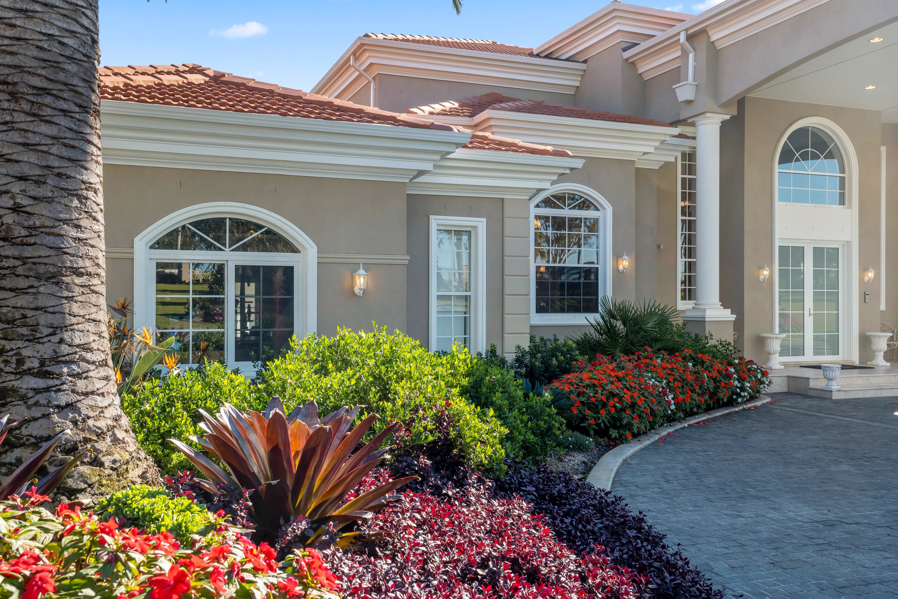
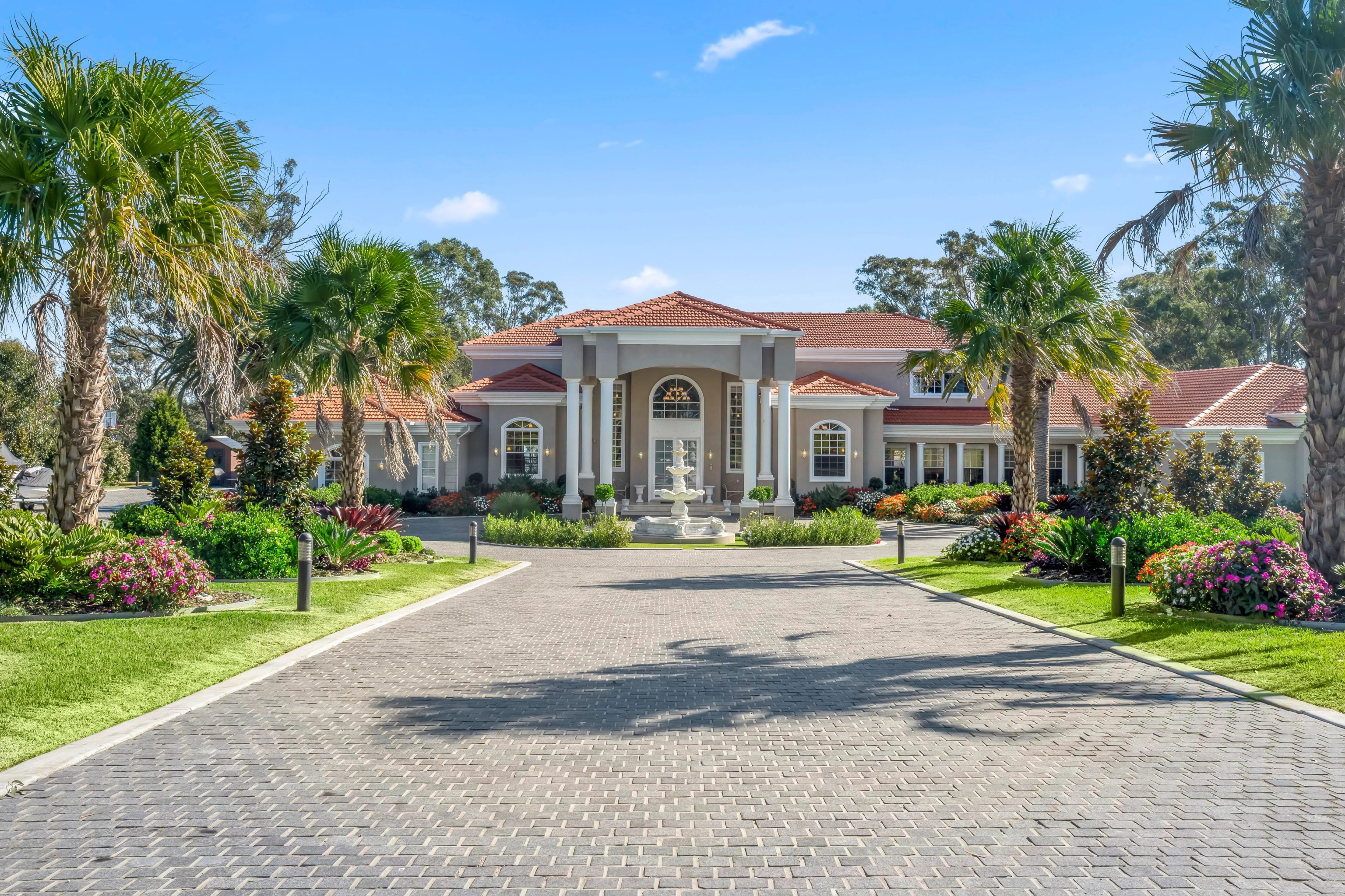
In Denham Court, SHORE designed and built CHATEAU (completed in 2021), a five acre French Provincial residence. Because Denham Court is split between Campbelltown City Council (64.9% of suburb area) and Liverpool City Council (35.1%) and the published map pin is an indicative suburb coordinate rather than a street address, we do not claim a confirmed parcel level build inside the Campbelltown council boundary. Completed work in Denham Court, Beverly Hills and Woonona is detailed below.
Select a pin or drag to explore
Map data: Esri, HERE, Garmin · © OpenStreetMap contributors
Darling Point · residential
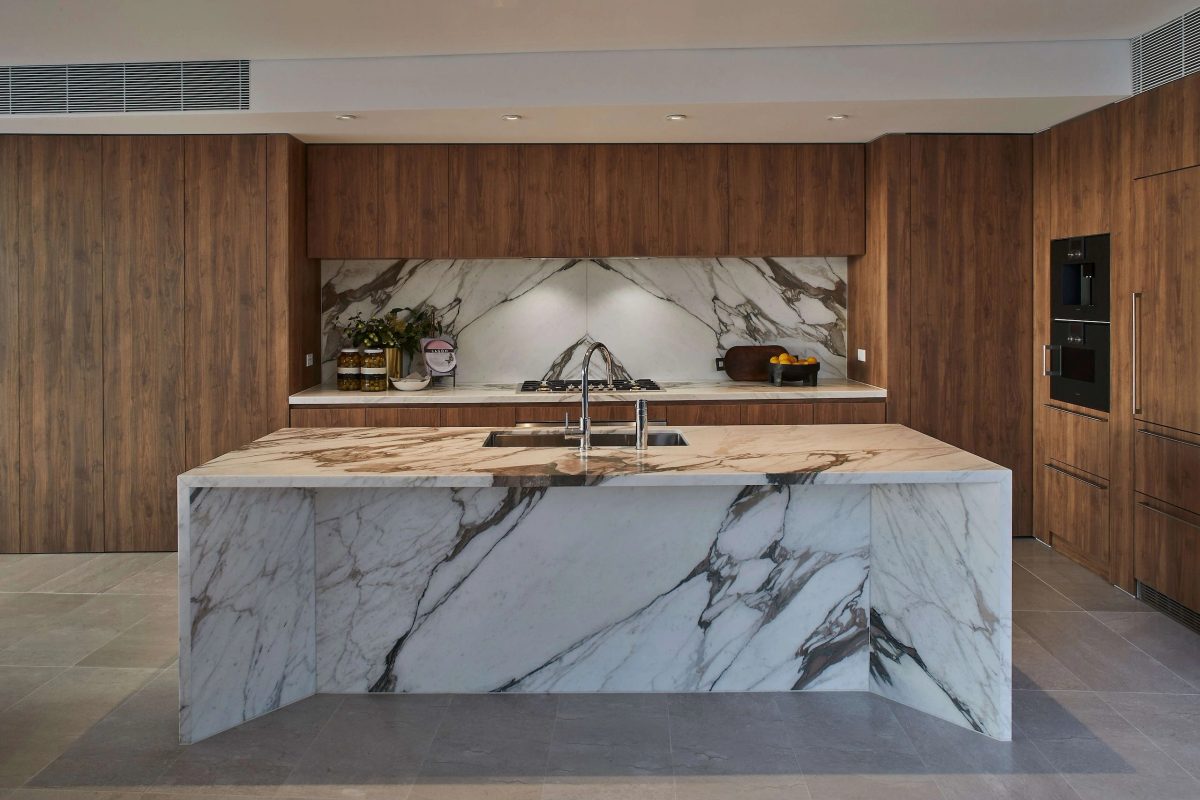
Five apartments arranged around Sydney Harbour views, with two basement levels. Completed in 2021, with architecture and interiors by Xpace.
Planning framework
Residential development in Campbelltown is governed by a statutory two storey limit and text based floor space ratios under clause 4.4(2A), paired with strict bushfire, slope, creek freeboard, salinity and mine subsidence controls.
Across the sample points we mapped under Campbelltown Local Environmental Plan 2015, 93.8% of Zone R2 low density land has an 8.5 metre building height limit (with the remainder at 9.0 metres) and 87.7% has a 500 square metre minimum subdivision lot size. Where the floor space ratio map shows no number, clause 4.4(2A) sets a 0.55:1 floor space ratio cap for dwelling houses and a 0.45:1 cap for dual occupancies across Zones R2, R3 and R5, while clause 4.3A caps houses, dual occupancies, semi detached dwellings and multi dwelling housing at two storeys. Within Zone C4 across the Glenfield Precinct and mapped Area 8 land, clauses 8.5 and 7.32 cap residential site coverage at 30%.
Under clause 4.1B, dual occupancies must satisfy the Lot Size for Dual Occupancy Development Map. Section 3.6.3.1 of the development control plan requires a 15 metre minimum lot width at the 5.5 metre street setback line in Zones R2, R3 and R5, with clause 4.1B(3) allowing subdivision in Zone R2 down to a 300 square metre minimum per resulting dwelling lot. Within 800 metres walking distance of Glenfield or Minto stations or a town centre on the Housing SEPP Town Centres Map, the low and mid rise standards of 450 square metres and 12 metres can apply instead. In Zones RU2 Rural Landscape, R5 Large Lot Residential, C3 Environmental Management and C4 Environmental Living, the land use table and clause 4.2A permit attached dual occupancies under a single roofline while prohibiting detached dual occupancies.
Schedule 5 Part 2 in Campbelltown Local Environmental Plan 2015 lists just one heritage conservation area across the entire municipality: the Queen Street Heritage Conservation Area (C1) in central Campbelltown. Almost all residential land sits outside that conservation area, though Schedule 5 Part 1 lists 106 heritage item rows (84 local and 22 state items, including colonial homesteads and the Upper Canal in Denham Court, Varroville, Gilead, Glenfield, Ingleburn and Menangle Park) where development on or adjoining a listed item requires a Statement of Heritage Impact under section 2.11.2 of the development control plan.
Mapped bushfire prone land covers 77.7% of our council sample overall, including 94.2% of Zones C3 and C4 and 25.0% of urban residential Zones R2 to R5; all asset protection zones must sit wholly inside the lot and retaining walls on bushfire prone land must be non combustible. Residential excavation and fill are capped at 1.0 metre each way, while steep Scenic Hills land over a 16% gradient requires consent for earthworks exceeding 0.5 metre under clause 7.8 and dark, low reflective external materials in Escarpment Preservation Areas under clause 7.6. Rooms adjacent to creeks, major stormwater lines or detention basins must sit at least 500 millimetres above the 100 year flood level (300 to 500 millimetres on overland flow paths), Wianamatta Shale sites require salinity management and southern suburbs in the South Campbelltown or Appin Mine Subsidence Districts require subsidence authority approval before lodging a development application.
How we work
Across Campbelltown, early coordination between architecture, hydraulic design and structural engineering prevents costly redesigns during assessment.
We check the zoning, minimum lot width at the 5.5 metre building line, two storey height cap, text based floor space ratio and any Volume 2 precinct chapter applying to your block.
We coordinate bushfire attack level assessments, overland flow and creek freeboard checks, Wianamatta Shale salinity testing and mine subsidence authority clearances where required.
Floor plans, roof forms, retaining walls and deep soil zones are resolved around solar access, natural contours and required boundary clearances.
We lodge through the complying development pathway or a Campbelltown City Council development application, finalise trade pricing and manage construction through to occupation.
Working together
Whether you are starting with a raw allotment or hold completed architectural documentation, we structure delivery around clear cost and program control.
Our architects, interior designers and builders take your home from feasibility and concept sketches through council or certifier approvals, engineering coordination and full construction under one agreement.
If you already have development approval or construction drawings from an independent architect, our estimating and delivery team reviews the detailing, site constraints and engineering to provide a comprehensive tender and build the residence.
Explore our work
Denham Court, NSW
Completed 2021
A French Provincial estate on five acres in Denham Court, completed in 2021 and designed and built by SHORE. Denham Court is split between Campbelltown City Council and Liverpool City Council; its suburb centre is about 3.8 kilometres from Ingleburn and 9.9 kilometres from Campbelltown in a straight line between suburb area centroids.
Beverly Hills
Completed 2026
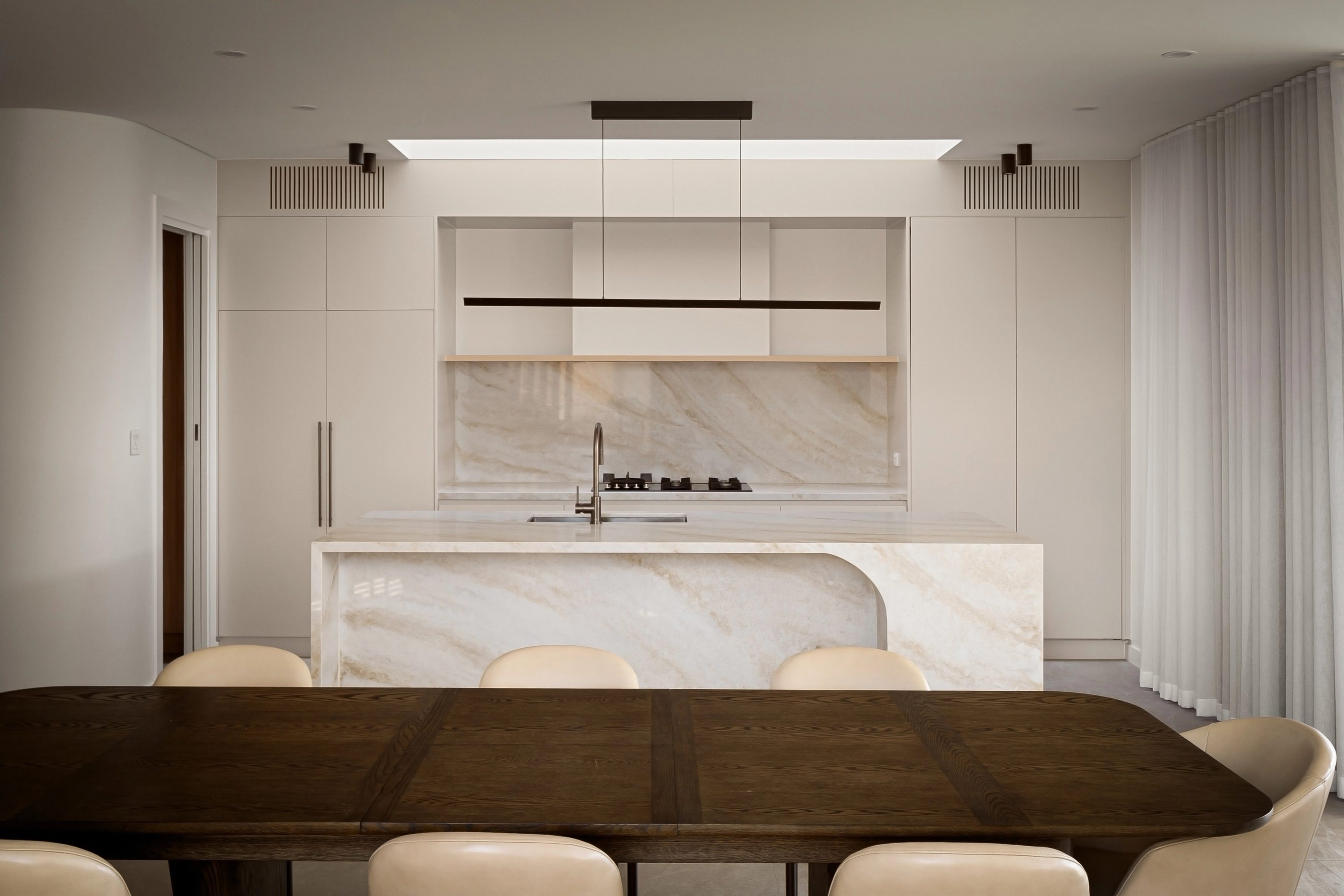
A sculptural white brick residence with curved forms and natural stone in Beverly Hills, completed in 2026. SHORE led the architecture, interiors and facade. Beverly Hills is about 17.4 kilometres from Glenfield and 18.0 kilometres from Macquarie Fields in a straight line between suburb area centroids.
Woonona, NSW
Completed 2024
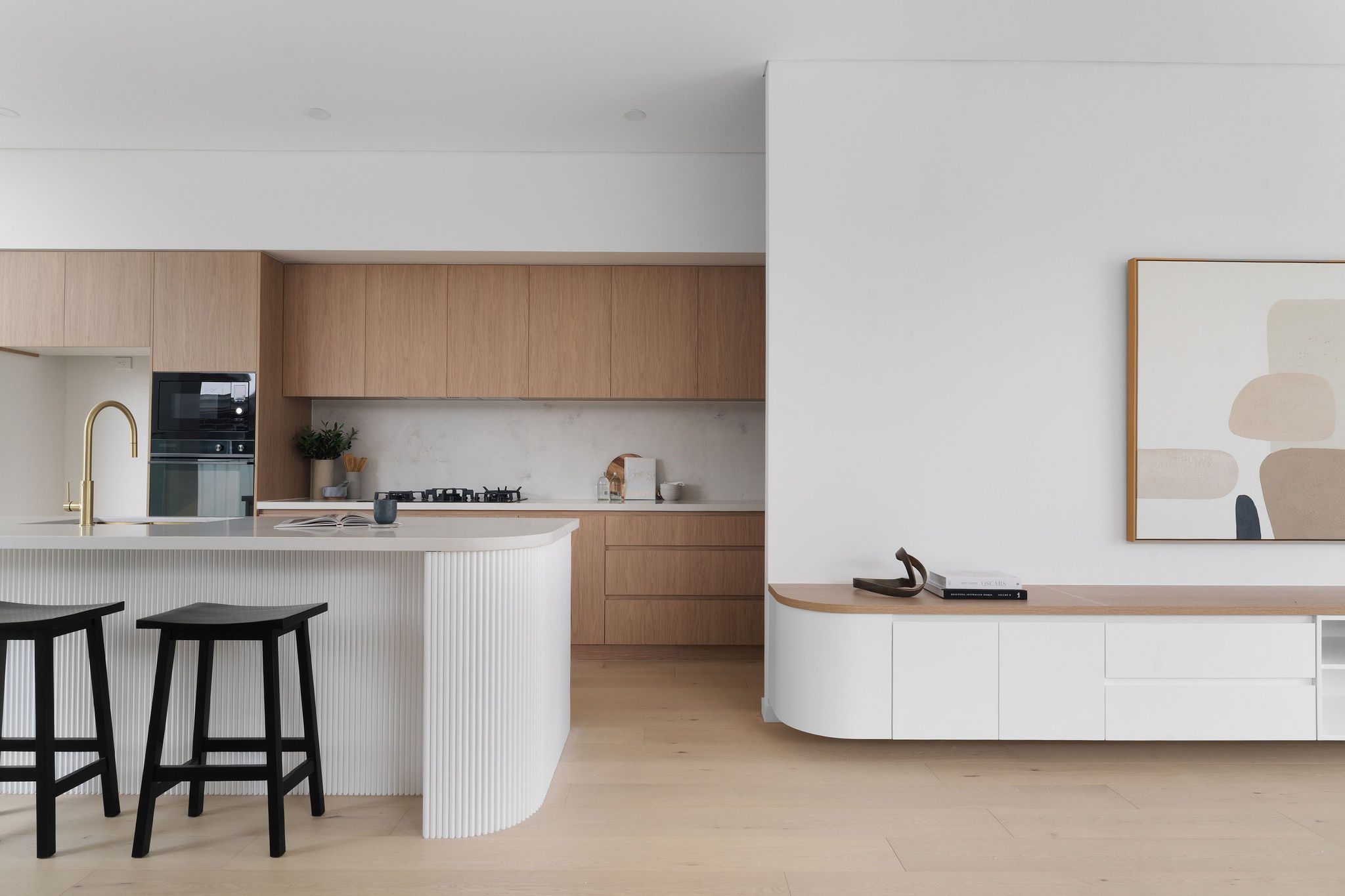
A contemporary coastal duplex in Woonona, completed in 2024. Architecture is by 10 Star Living, with interiors and facade by SHORE, built by SHORE. Woonona is about 23.9 kilometres from Wedderburn and 25.6 kilometres from Gilead in a straight line between suburb area centroids.
Service directory
This council guide covers 35 localities assigned to this municipal map directory: Airds, Ambarvale, Bardia, Blair Athol, Blairmount, Bow Bowing, Bradbury, Campbelltown, Claymore, Denham Court, Eagle Vale, Englorie Park, Eschol Park, Gilead, Glen Alpine, Glenfield, Holsworthy, Ingleburn, Kearns, Kentlyn, Leumeah, Long Point, Macquarie Fields, Macquarie Links, Menangle Park, Minto, Minto Heights, Raby, Rosemeadow, Ruse, St Andrews, St Helens Park, Varroville, Wedderburn and Woodbine.
Commonwealth defence land covers the council portion of Holsworthy. Public reserves and environmental management land cover most of Long Point, so check zoning before assuming a buildable lot. Two northern localities also straddle neighbouring municipal boundaries, making a parcel check the essential first step on every brief.
Questions to bring early
Under Campbelltown Local Environmental Plan 2015, most Zone R2 low density land has an 8.5 metre building height limit (9.0 metres in parts of R2 and across 98.8% of Zones C3 and C4) and clause 4.3A restricts dwelling houses to a maximum of two storeys above ground. Clause 4.4(2A) sets a 0.55:1 floor space ratio limit for dwelling houses in Zones R2, R3 and R5 while undercover parking above 36 square metres for a three or more bedroom house counts toward gross floor area under section 3.6.1.4 of the development control plan. Standard Zone R2 and R3 houses require a 15 metre lot width at the 5.5 metre street building line (unless an existing lot), 5.5 metre front setback (6.0 metres to garages), 0.9 metre side setbacks (1.2 metres where a boundary retaining wall is built), 3.0 metre rear setback up to 4.5 metres in height, 8.0 metre rear setback above 4.5 metres in height and at least 20% deep soil planting.
Under clauses 4.1B and 4.4(2A)(b) of the local plan and section 3.6.3.1 of the development control plan, dual occupancies in Zones R2, R3 and R5 are capped at a 0.45:1 floor space ratio and two storeys, must satisfy the Lot Size for Dual Occupancy Development Map (700 square metres standard in established areas, with smaller release thresholds in Mount Gilead under clause 4.1I and Menangle Park under clause 4.1J) and require a 15 metre minimum width at the 5.5 metre front setback line. In Zone R2, clause 4.1B(3) allows subdivision of a dual occupancy where each new lot measures 300 square metres or more while clause 4.1C permits semi detached dwellings on a 700 square metre parent lot subdivided into 300 square metre lots (with specific variations on mapped Ingleburn Narrow Lots). In Zones RU2, R5, C3 and C4, only attached dual occupancies under one roofline are permissible while detached dual occupancies are prohibited.
Yes, on qualifying residential lots in Zones R2, R3 and R5 (and eligible rural or greenfield release lots) that meet every numerical envelope and land standard under the Codes SEPP 2008. However, complying development under the Housing Code is excluded on land zoned C3 Environmental Management or C4 Environmental Living in suburbs such as Varroville, Wedderburn, Kentlyn or Minto Heights, on bushfire prone lots rated BAL 40 or Flame Zone, on listed heritage items or inside the Queen Street Heritage Conservation Area (except for limited detached ancillary works). Those properties need a council development application to Campbelltown City Council.
Four local controls regularly shape project budgets. First, bushfire exposure across 77.7% of our council sample (including 94.2% of Zones C3 and C4 and a quarter of urban residential points) requires BAL rated glazing, ember seals, wholly internal asset protection zones and non combustible retaining walls. Second, residential excavation and fill caps of 1.0 metre (and a 0.5 metre consent trigger on steep Scenic Hills slopes above 16%) call for stepped floorplates and engineered retaining walls where heights exceed 600 millimetres. Third, Wianamatta Shale salinity, creek or overland flow freeboard of 300 to 500 millimetres and mine subsidence rules in the South Campbelltown and Appin districts govern slab and footing specifications. Fourth, the Campbelltown Local Infrastructure Contributions Plan 2018 Amendment 2 levies Section 7.11 contributions on additional dwellings or lots and Section 7.12 percentage levies on development cost prior to construction certificate release.
Project enquiry